


Improving stream connectivity and restoring aquatic ecosystems in Wisconsin
How Cadmus helped a leading environmental organization break down barriers in a Wisconsin stream network.
The Nature Conservancy is a leader in the protection and restoration of ecosystems throughout the world. As part of their conservation mission, they work closely with public and private partners to advance restoration science and identify actions to address the most pressing conservation challenges.
Challenge
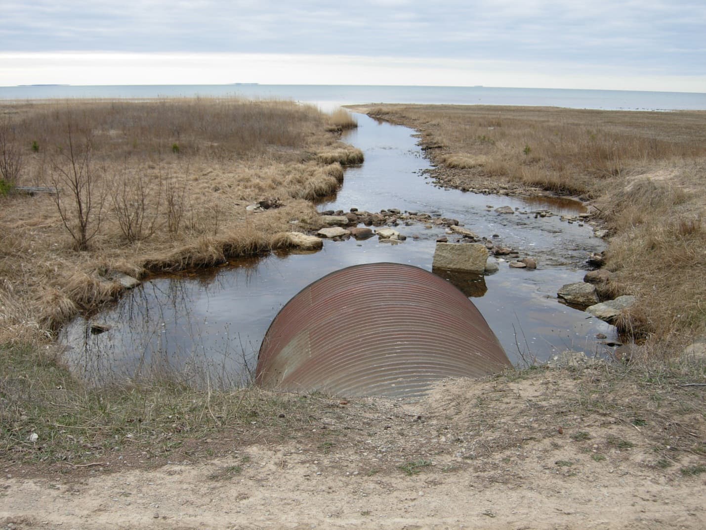
The development of infrastructure in the United States has resulted in the placement of numerous dams, culverts, weirs, and other structures in the nation’s rivers and streams. These barriers artificially divide the stream network and detrimentally affect populations of fish and other organisms that rely on aquatic pathways.
Selective removal and restoration of the most harmful barriers has become an area of focus for conservation organizations like The Nature Conservancy. Cadmus’ watershed science team was retained by The Nature Conservancy to improve understanding of the benefits of removing barriers to fish passage in Wisconsin and to develop mapping tools that lead to effective and efficient restoration investments.
Solution
In partnership with the Wisconsin Department of Natural Resources, Cadmus worked in Wisconsin’s Duck-Pensaukee and Green Bay watersheds to evaluate current stream connectivity and assess options for improvement. We conducted field inspections of hundreds of road-stream intersections to determine whether the culverts and bridges interrupted the stream connectivity or created flow constrictions that discourage aquatic species passage. We then used field data to evaluate the connections between each stream in the watershed and calculate a connectivity score for the watershed that considers:
- Stream length.
- Aggregate effects of multiple barriers.
- The importance of access to multiple habitat types (e.g., small streams and large streams).
Cadmus also produced geographic information system (GIS)-based tools that allow users to identify optimal barrier removal options that result in the greatest gains in connectivity, given a user-defined budget.
Results
Cadmus’ data-driven approach provided The Nature Conservancy with a pragmatic solution to an environmental challenge that is receiving increased attention from the aquatic restoration community. Our research and tools are now helping to shape aquatic restoration activities in Wisconsin and in other locations in the U.S. The GIS-based tools developed by Cadmus:
- Allow restoration planners to quickly assess gains in connectivity resulting from the removal or upgrade of one or more barriers in a watershed.
- Facilitate the targeting of limited restoration resources and inform conversations between environmental organizations and local officials responsible for the maintenance of critical infrastructure.
Learn more about our Watershed Science and Management services.